


When selecting a plot of land for residential development, decisive factors include price, construction possibilities, zoning plans, and technical conditions. But there's an equally important question that's much harder to evaluate: how good is the location itself for a future residential project? In this article, we'll show you how to measure Residential Attractiveness, both today and for the future.
How good is the location itself for a future residential project?
A developer may compare several plots with similar parameters, yet their surroundings can offer significantly different conditions. In one place, the necessary civic amenities are already in place; in another, some services are missing. And another location might seem less attractive today, but its character could change in the coming years due to planned construction.
How can these differences be translated into a form that allows locations to be genuinely compared?
How to find a good residential location using data
Two apartments can have the same price per square meter and still offer completely different everyday living conditions.
One has a school, doctor, park, and public transit within walking distance. The other is dominated by shops, but lacks greenery and quiet. How can such a difference be described in data-driven, comparable terms?
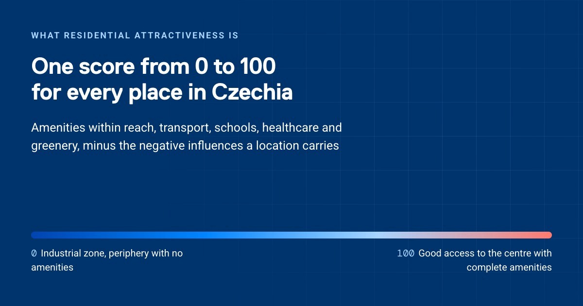
At CleverMaps, we developed Residential Attractiveness, a functional evaluation model that converts service accessibility, amenity diversity, and negative influences into a 0–100 score for locations across the Czech Republic.
This isn't just about counting points of interest within a radius around an address. The model works with real walking accessibility, accounts for distance, and recognizes that the first pharmacy or kindergarten nearby contributes more value than the fifth. It uses a "category cap", a limit on how much a given category can contribute to the overall score. This means a high concentration of shops can't mask missing schools, greenery, or healthcare facilities.
As a result, the output shows not just which location scores better, but also why. The weights were developed by combining data with interpretation, and can be technically adjusted to fit the needs of a specific client or target group.
How to choose land for housing effectively
During land acquisition, a developer no longer has to compare locations based solely on individual points of interest or a general impression of the surroundings.
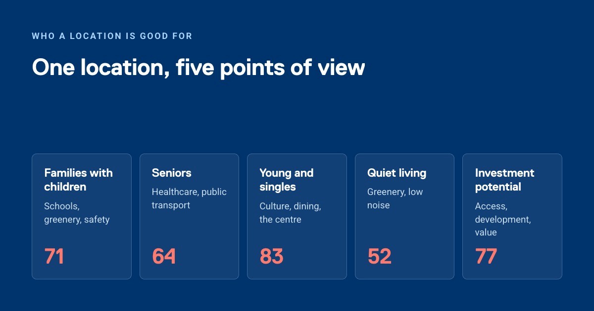
They can look, for example, at whether future residents will have schools, healthcare, shops, public transit, sports facilities, or green space within walking distance. At the same time, they can see where a location's weak points are and which amenity categories are dragging down its attractiveness.
This makes it possible to ask more specific questions about each plot:
Which location has more balanced civic amenities?
What's missing in the surroundings of each plot?
Are important services actually accessible on foot?
What negative factors might be reducing the location's residential attractiveness?
How does the result change when we view the location through the lens of a specific target group?
Residential Attractiveness doesn't replace comprehensive property due diligence. It adds another dimension to it, a comparable data-driven view of the plot's surroundings and the conditions for future residents' everyday life.
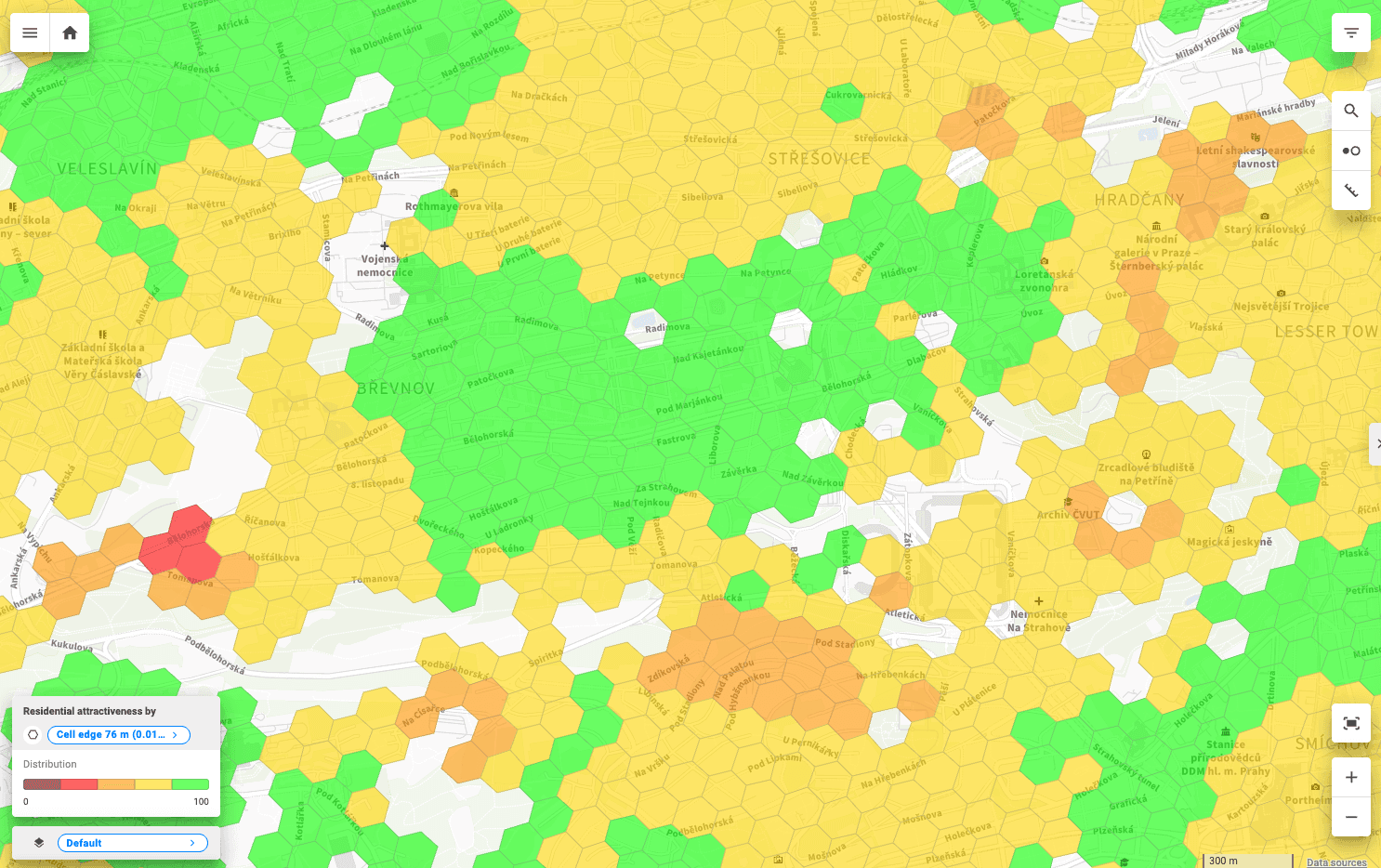
Residential Attractiveness, a data product by CleverMaps, visualized in CleverMaps.
Not every residential project needs the same thing
When comparing locations, the overall score isn't the only thing that matters. A project aimed at families with children might place greater emphasis on schools, kindergartens, parks, or sports facilities. For a different target group, public transit, healthcare, services, or culture might be more important.
The weighting of individual categories can therefore be technically adjusted according to the needs of a specific client or target group. This allows a developer to assess a location not just in general terms, but also in the context of the specific residential project planned for that site.
What about a location that isn't "finished" yet?
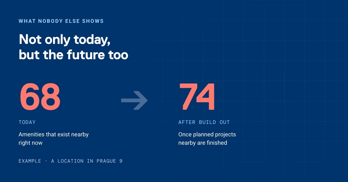
In development, it's important not to judge a plot only by what currently exists in its surroundings. Another area of development is the concept of future attractiveness, which incorporates planned construction into the evaluation and shows how a location's potential might change.
A new school, park, services, or additional development could mean that a location with lower current attractiveness will look very different by the time a project is completed.
Comparing current and future residential attractiveness can add another perspective when deciding between several plots.
From land selection to location risk assessment
Where can Residential Attractiveness by CleverMaps help? Let's break it down:
Developers: selecting and comparing locations
Real estate portals: providing clearer descriptions of surroundings
Banks and investors: assessing location risk
Cities: identifying areas with missing amenities
For developers, the key benefit is the ability to compare multiple candidate locations using the same methodology and understand what's driving the results.
Choosing land will always involve a combination of many factors. But the quality of its surroundings doesn't have to remain just a claim that it's a "good location." It can be described with data, compared to other places, and examined for its strengths and weaknesses.
If you work in real estate, development, or urban planning and want to compare your own locations, get in touch with us. We'd be happy to show you what can be learned from their surroundings.
Frequently Asked Questions
What is Residential Attractiveness?
A CleverMaps evaluation model that converts service accessibility, amenity diversity, and negative influences in a location's surroundings into a 0–100 score.
How is the Residential Attractiveness score calculated?
The model uses real walking accessibility and a so-called category cap, which prevents one strong category (e.g., shops) from masking weaknesses in others (e.g., schools or green space).
Who is Residential Attractiveness for?
Developers selecting land, real estate portals, banks and investors assessing location risk, and cities planning amenities.
Can the evaluation be customized for a specific project?
Yes. The weighting of individual categories (schools, healthcare, public transit, green space, and others) can be technically adjusted based on the target group or project type.
Does the model account for future development of a location?
Yes, the future attractiveness concept incorporates planned construction and shows how a location's potential may change by the time a project is completed.
Does Residential Attractiveness replace land due diligence?
No. It complements comprehensive property due diligence with a comparable data-driven view of the surroundings, rather than replacing it.